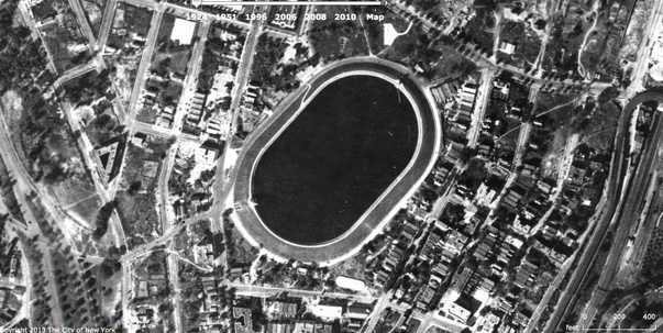
Williamsbridge Oval in 1924 when it was a swimming hole, aerial view, found
on the NYCH2O
website. In the lower left, the
pre-Robert-Moses Mosholu Parkway To the right: Webster Avenue and the
railroad tracks and a bit of Bronx Park, which dates back to about 1904.
Upper right: Gun Hill Road. I'm guessing the the little object on the rim
in the lower left, where Van Cortlandt Avenue East runs into the Oval, is
the old gate house, the same place where the tunnel entrance to the park is
now.